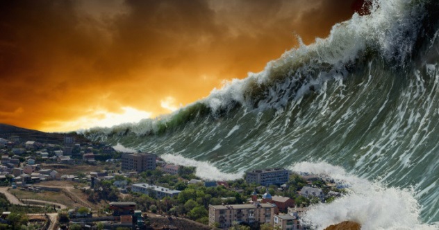
Nature does not keep a shared calendar, accept meeting invitations, or politely announce, “Major earthquake scheduled for Tuesday at 2:15 p.m.” Scientists therefore cannot predict the exact date and location of most natural disasters. What they can do is identify dangerous trends, calculate probabilities, reconstruct ancient events, and model realistic scenarios.
When researchers describe a disaster as likely in the near future, they usually mean that it has a meaningful chance of occurring within the next several decades. Some threats, such as rising coastal flooding and extreme heat, are already intensifying. Others, including a Cascadia megathrust earthquake, remain uncertain in timing but inevitable over a long enough period.
The following list examines 10 major natural disasters predicted or considered scientifically plausible in the coming decades. These are not prophecies carved into a mysterious stone tablet. They are evidence-based risk assessments intended to help governments, businesses, and households prepare before the lights flicker, the ground moves, or the neighborhood suddenly needs a canoe.
Why Scientists Study Future Natural Disasters
Forecasting natural hazards involves several kinds of evidence. Geologists study fault movement, sediment layers, ancient tsunamis, and previous volcanic eruptions. Meteorologists analyze ocean temperatures, atmospheric circulation, storm behavior, and precipitation records. Climate scientists use observations and computer models to estimate how heat, drought, flooding, wildfire, and tropical cyclones may change as the planet warms.
Emergency planners then combine the likelihood of an event with human exposure. A powerful earthquake in an empty desert is a geological spectacle. The same earthquake beneath a densely populated city is a catastrophe. Vulnerability, building quality, evacuation routes, health services, power systems, and public preparation all help determine whether a natural hazard becomes a major disaster.
10 Major Natural Disasters Scientists Are Watching
1. A Cascadia Megathrust Earthquake and Pacific Northwest Tsunami
The Cascadia Subduction Zone stretches roughly 700 miles from northern California to British Columbia. There, the Juan de Fuca Plate is being forced beneath the North American Plate. The fault can produce enormous earthquakes similar to the 2011 Tōhoku earthquake in Japan.
USGS assessments place the probability of an approximately magnitude 9 Cascadia earthquake at about 10% to 15% during a 50-year period. Such a rupture could generate several minutes of severe shaking, damage bridges and utilities, trigger landslides, and send a tsunami toward coastal communities within minutes.
The greatest concern is not simply the size of the earthquake. Many coastal areas have limited evacuation routes, while older buildings and transportation systems were not designed for prolonged shaking. Residents near the ocean may need to reach high ground on foot because roads could be blocked or damaged.
2. A Major California Earthquake
California’s next damaging earthquake does not have to be the cinematic “Big One” to create widespread disruption. The state contains hundreds of faults, including the San Andreas, Hayward, Calaveras, and San Jacinto systems.
The USGS UCERF3 model estimated a greater than 99% probability of at least one magnitude 6.7 or larger earthquake somewhere in California during its 30-year forecast window. It also raised the estimated probability of a magnitude 8 or larger California earthquake to approximately 7% within that window.
A major rupture could interrupt water supplies, freight routes, telecommunications, fuel distribution, and electricity across multiple counties. Fire following an earthquake is another serious danger because broken gas lines may ignite while damaged roads and water mains slow emergency crews. The ground may stop shaking after a few minutes, but the economic aftershocks could continue for years.
3. A Destructive New Madrid Seismic Zone Earthquake
The central United States is not usually associated with dramatic earthquakes, which is exactly why the New Madrid Seismic Zone deserves attention. Located around parts of Missouri, Arkansas, Tennessee, Kentucky, and Illinois, the zone produced a sequence of extremely powerful earthquakes in 1811 and 1812.
USGS materials describe a continuing risk of a major destructive earthquake and cite a roughly 25% to 40% probability of a magnitude 6 or greater event over a 50-year period in some planning assessments.
Earthquake waves travel efficiently through the older, denser crust of the central and eastern United States. As a result, strong shaking could be felt across a much larger area than a similar event in California. Vulnerable masonry buildings, pipelines, bridges, river infrastructure, and levees around cities such as Memphis and St. Louis could face serious damage.
4. Another Cascade Range Volcanic Eruption
Forget the internet’s favorite Yellowstone apocalypse. USGS scientists emphasize that Yellowstone is not overdue and shows no evidence of an impending giant eruption. A more realistic volcanic threat exists in the Cascade Range, which includes Mount St. Helens, Mount Rainier, Mount Hood, Mount Baker, and several other active volcanoes.
Eruptions have occurred in the Cascades at an average rate of one or two per century over the last 4,000 years, and the USGS states plainly that future eruptions are certain. Mount St. Helens is considered the Cascade volcano most likely to erupt again within our lifetimes.
An eruption could produce ashfall, aviation closures, pyroclastic flows, and laharsfast-moving mixtures of water, mud, rock, and volcanic debris. Around glacier-covered Mount Rainier, lahars could travel far downstream into developed valleys even if the eruption itself were relatively modest.
5. A California ARkStorm Megaflood
California’s disaster planning is often dominated by drought and earthquakes, but geological evidence shows that the state can also experience exceptionally long and destructive periods of rain. The USGS ARkStorm scenario explores what might happen if a sequence of powerful atmospheric rivers produced precipitation comparable to the storms of 1861 and 1862.
ARkStorm is a scientifically realistic scenario rather than a dated forecast. It models weeks of heavy precipitation, flooding, landslides, strong winds, infrastructure failures, agricultural losses, and widespread displacement.
Low-lying portions of the Central Valley could experience extensive flooding, while mountain communities might be isolated by landslides and damaged roads. Reservoir management would become extraordinarily difficult as officials tried to balance flood protection, dam safety, and water storage. In other words, California could go from asking where the rain went to asking it to kindly leave.
6. A Rapidly Intensifying Major Atlantic Hurricane
The total number of future Atlantic hurricanes remains uncertain, but researchers have stronger evidence that warmer conditions can increase hurricane rainfall, maximum intensity, coastal inundation, and the possibility of rapid intensification.
NOAA assessments indicate that future hurricanes are likely to produce higher rainfall rates and stronger winds, with the possibility of a greater proportion reaching Category 4 or Category 5 strength. Rising sea levels will allow storm surge to travel farther inland. Research also suggests that rapid intensification near the U.S. coast may become a growing concern, reducing the time available for evacuation.
A particularly dangerous near-future scenario is a storm that strengthens dramatically shortly before landfall along the Gulf Coast or Atlantic Coast. Communities could prepare for a moderate hurricane and suddenly confront a much stronger one, while crowded roads, hospitals, ports, refineries, and power systems struggle to adjust.
7. A Long-Duration Extreme Heat Disaster
Extreme heat is less visually dramatic than a tornado, yet it can affect millions of people simultaneously and place enormous pressure on health systems, electricity networks, transportation, agriculture, and water supplies.
EPA, CDC, and NOAA projections indicate that U.S. heat waves will become more frequent, intense, and long-lasting in the coming decades. The danger is especially high when hot daytime temperatures are followed by warm nights that prevent the body, buildings, and electrical equipment from cooling.
A severe multistate heat dome could push electricity demand to record levels. If power failures disabled air conditioning, elevators, refrigeration, traffic signals, and medical equipment, a weather event could rapidly become a public-health emergency. Older adults, outdoor workers, infants, people with chronic diseases, and households without reliable cooling would face the greatest danger.
8. A Western Megafire Outbreak
Wildfire has always been part of many western ecosystems, but warmer temperatures, prolonged drought, dry vegetation, expanding development, and simultaneous fire weather are increasing the potential for disasters that overwhelm firefighting resources.
NOAA research identifies climate change as a major driver of increasing western fire weather. NASA reports that, by around 2050, the amount of land burned by wildfire in Western states could increase by approximately two to six times, depending on location and future conditions.
The most troubling scenario is not one gigantic flame front but numerous large fires burning at the same time. Aircraft, crews, evacuation shelters, emergency dispatchers, and equipment could be stretched thin across several states. Smoke may travel hundreds or thousands of miles, exposing communities far from the flames to dangerous air pollution.
9. A Renewed Southwestern Megadrought and Water Emergency
A wet year does not erase the long-term vulnerability of the Southwest. Rising temperatures increase evaporation from soil, vegetation, rivers, and reservoirs. Warmer winters also cause more precipitation to fall as rain instead of snow, while mountain snowpacks tend to melt earlier.
NOAA-supported research shows that increasing atmospheric demand for moisture has become a major contributor to the severity and geographic extent of western drought. National climate assessments also project continued snow drought and earlier runoff in many western watersheds.
A future multiyear drought could reduce Colorado River flows, strain groundwater reserves, damage crops, increase dust and wildfire risk, and intensify disputes among cities, agricultural districts, states, and tribal nations. The disaster would unfold slowly, without a single dramatic starting moment, but its consequences could reshape where and how millions of people live.
10. Chronic Coastal Flooding Combined With a Major Storm
Sea-level rise is already changing the starting point from which every tide and coastal storm operates. NOAA projects that average sea level along the U.S. coastline will rise roughly 10 to 12 inches between 2020 and 2050, with substantial regional variation.
By 2050, damaging coastal flooding is expected to occur, on average, more than 10 times as frequently as it does today. Along parts of the East and Gulf Coasts, land subsidence could make relative sea-level rise even greater.
The major disaster scenario involves rising baseline seas combining with storm surge, extreme rainfall, high tide, and overloaded drainage systems. Water may arrive from the ocean, sky, rivers, and storm drains at the same time. Roads, wastewater plants, electrical substations, hospitals, ports, and homes that previously sat outside frequently flooded areas could experience repeated damage.
Which Predicted Natural Disaster Is Most Likely?
There is no single answer because likelihood depends on time scale and definition. Extreme heat, wildfire weather, heavy rainfall, and coastal flooding are already occurring and are projected to intensify. Another damaging U.S. hurricane is inevitable, although its location and strength cannot be known far in advance.
Large earthquakes and volcanic eruptions are harder to rank. They may not occur this year or even this decade, but geological evidence shows that they will eventually happen. Their lower annual probability is balanced by their potential for enormous consequences.
FEMA’s national risk framework evaluates communities across multiple natural hazards because disasters rarely remain neatly separated. Heat can worsen drought. Drought can prepare vegetation to burn. Wildfire can remove plants that stabilize soil. The next heavy storm can then trigger debris flows and flash flooding. Nature is an enthusiastic collaborator, although regrettably not the helpful kind.
Experience-Based Lessons From Disaster Warnings
People who have lived through hurricanes, earthquakes, fires, floods, and prolonged power failures frequently describe the same realization: the emergency itself is only one chapter. The days before and after the event often determine whether a household merely experiences disruption or enters a genuine crisis.
The Warning May Feel Uncertain Until It Suddenly Does Not
Consider the experience of a family living near a hurricane evacuation zone. Early forecasts show several possible tracks, so neighbors continue shopping, working, and debating whether the storm will turn. One model shifts east. Another shifts west. Social media confidently announces both total destruction and absolutely nothing, occasionally within the same five-minute period.
Then the forecast tightens. Gas stations become crowded. Hardware stores run low on plywood and batteries. Hotels fill, traffic thickens, and the family discovers that making a decision under pressure is much harder than making a plan in advance. The lesson is not to panic at every forecast cone. It is to decide beforehand which official trigger will prompt evacuation and where everyone will go.
Small Practical Problems Become Surprisingly Important
During a multiday outage, the glamorous survival equipment often receives the attention, but ordinary details create the most frustration. Phones need charging. Prescription medicine must remain available. Refrigerated food begins to spoil. Electronic payment systems fail. Pets need water and transportation. A garage door may not open without power, and a family’s beautifully packed emergency supplies may be stored directly behind it.
Experienced households therefore build preparation around daily needs rather than action-movie fantasies. They keep flashlights where people can actually find them in the dark, maintain a small cash reserve, store drinking water, copy important documents, and learn how to shut off utilities. They also test equipment. An unopened generator that has not been started in four years is less an emergency tool than an extremely heavy conversation piece.
Communication Plans Matter as Much as Supplies
Disasters frequently separate families during school, work, travel, or routine errands. Cellular networks may become overloaded even when towers remain operational. A simple plan can identify an out-of-area contact, two meeting locations, evacuation responsibilities, and the person assigned to help children, older relatives, neighbors, or animals.
Text messages may work when voice calls do not. Paper contact lists are useful when a phone battery dies. Local emergency alerts provide more reliable instructions than rumors passed through neighborhood group chats. The practical experience is straightforward: information becomes a resource, and unverified information can become a hazard.
Recovery Is Usually Longer Than Expected
After the wind stops or the water recedes, insurance claims, repairs, temporary housing, school closures, transportation problems, smoke exposure, and emotional stress may continue for months. Photographs of belongings, property records, policy documents, medication lists, and receipts can make recovery less chaotic.
Community relationships also matter. A neighbor with a chainsaw, spare room, working vehicle, medical training, or simply accurate information may be more useful than an expensive gadget. The strongest disaster preparation is not built around fear. It is built around redundancy, cooperation, realistic planning, and the humble acceptance that canned food occasionally requires a manual can opener.
Conclusion
The 10 major natural disasters predicted in the near future range from sudden geological events to slow-building climate emergencies. Scientists cannot tell us the exact day of the next Cascadia earthquake, Cascade eruption, California megaflood, or catastrophic hurricane. They can, however, show where risks are increasing and what the consequences may look like.
The most useful response is neither denial nor doomsday obsession. Communities can strengthen buildings, protect evacuation routes, modernize power and water systems, improve forecasts, manage vegetation, restore natural flood protection, and plan for vulnerable populations. Households can prepare supplies, alerts, documents, medications, communication plans, and evacuation options.
A hazard may be unavoidable, but the scale of the disaster is not predetermined. Preparation cannot stop the ground from moving or the ocean from rising. It can ensure that when nature behaves badly, people are ready to behave intelligently.
Research note: This article synthesizes public hazard assessments and projections from the U.S. Geological Survey, National Oceanic and Atmospheric Administration, National Aeronautics and Space Administration, Federal Emergency Management Agency, Environmental Protection Agency, Centers for Disease Control and Prevention, and the U.S. National Climate Assessment. The scenarios describe credible risks rather than exact event predictions.